Satellite Image Analysis Reveals the Extent of Damage in Iran Since the War Began
SadaNews - Amid increasing restrictions on the flow of information from within Iran, coupled with internet disruptions in vast parts of the country, satellite images have become an essential tool for understanding what is happening on the ground and assessing the extent of damage caused by military strikes.
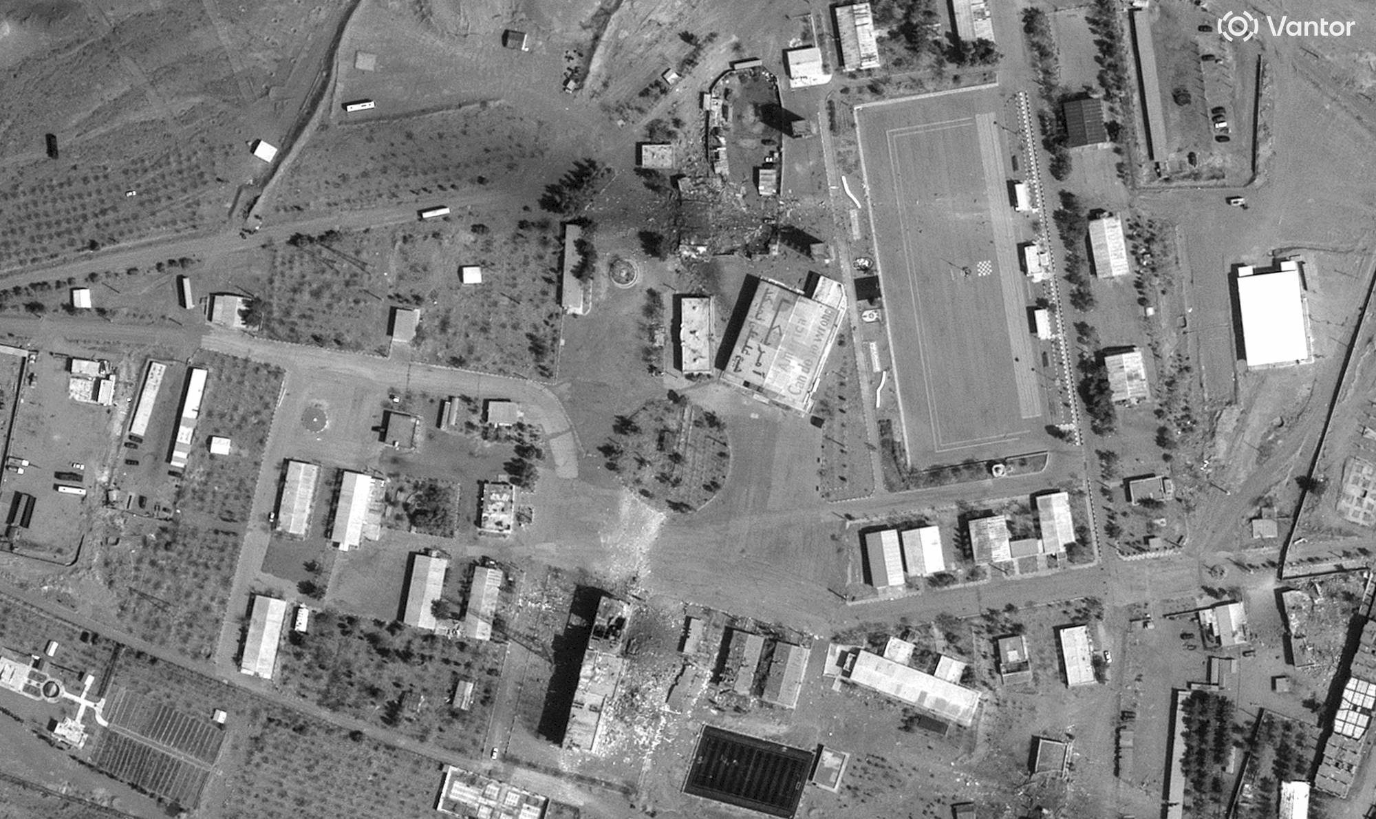
In this context, a new analysis of satellite data has unveiled a preliminary large-scale image of the damage inflicted on facilities in various regions of Iran since the outbreak of the U.S.-Israeli war against Tehran about two weeks ago.
According to the Washington Post, this analysis published by researchers from Oregon State University on Friday provides one of the most comprehensive pictures to date regarding the extent of the destruction suffered by various facilities across the country since the beginning of the attacks.
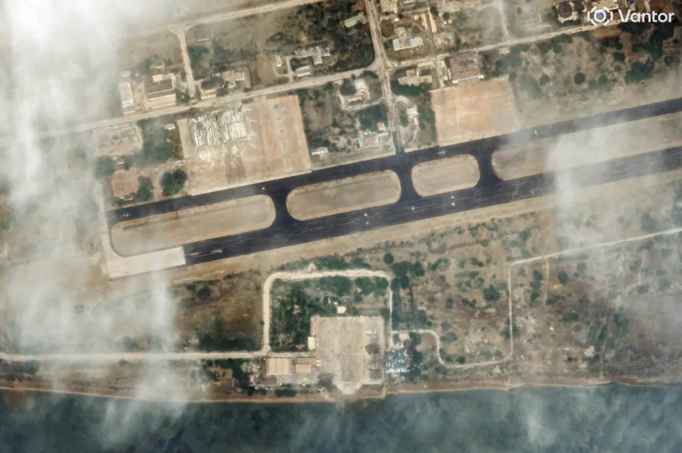
The study results indicate that the damage was extensive, particularly concentrated in the capital city of Tehran, the largest city in Iran by population, as well as in the city of Shiraz located in the southern central part of the country. The data also showed that the coastal city of Bandar Abbas has seen damages to over 40 facilities.
Strategically, Bandar Abbas is of great importance as it houses one of Iran's main naval bases and is located near the Strait of Hormuz, a vital maritime corridor through which about one-fifth of the world’s oil supplies pass. Amid current military tensions, oil-laden ships are piling up in the region, with rising concerns over potential attacks that Iran may launch on shipping traffic.
This analysis was conducted by researchers Corey Scher and Jamon Van Den Hoek from the "Conflict Ecology Research Lab," a lab specialized in analyzing geospatial data, affiliated with Oregon State University. The researchers implemented techniques they previously applied in studies examining the impacts of armed conflicts in different regions around the world.
Van Den Hoek stated that the pattern of damage observed reflects the nature of strikes that do not concentrate in a traditional combat front, explaining: "It is clear that there is no defined combat front at this moment; the damage is occurring in scattered areas of Iran over a very short period of time."
In their study, the researchers relied on comparing data captured by the "Sentinel-1" satellite before the attack commenced on February 28, with other data collected between March 2 and 10.
The "Sentinel-1" satellite utilizes radar technology to monitor changes occurring on the Earth's surface, allowing for the detection of damage or destruction that may happen to buildings and facilities; however, this type of analysis does not capture damage in agricultural areas or regions with dense vegetation or undeveloped areas.
The researchers highlight that while this technique provides a unique window for monitoring changes across large areas of Iranian land, it may not be able to detect smaller or limited damages.

High-level sources reveal to SadaNews: Washington seeks to hold a Gaza Reconstruction Conf...

Yedioth Ahronoth: Israel Decides to Establish Settlement in the Heart of Hebron for the Fi...

تدقيق خارجي يؤكد التزام السلطة بوقف ربط المساعدات بملف الأسرى والشهداء والاحتلال يواصل الت...

Report: America is considering strengthening its relations with the Palestinian Authority

A Comprehensive Colonial Plan: Occupation Swallows Northern West Bank with 18 New Settleme...

SadaNews Reports on Key Hebrew Channels' Coverage of Iran, Lebanon, and the Israeli-Americ...

The Israeli government allocates a budget to fund the terrorist settlement organization "Y...
