

China Monitors Stealth Bombers: How Is the World's Most Expensive Stealth System Eroding?
SadaNews - On the morning of March 1st, 4 B-2 Spirit stealth strategic bombers took off from their bases heading towards Iran on a mission to strike missile facilities buried under the mountains in Iran as part of the first wave of "Epic Fury" operation. The American stealth bombers, the most expensive in history, costing over $2 billion each, were designed for one purpose: to reach and strike their target, then return without anyone knowing they were there.
The following day, a Chinese company called "Jingan Technology," a military service provider for the People's Liberation Army, announced on social media that it had identified the presence of those bombers. It claimed that its "Jingqi" war event monitoring system intercepted radio signals from the four bombers and identified their communication signals, from Petro 41 to Petro 44 (these numbers refer to the sequences of military formations; where the first number reflects the squadron or formation, and the second number reflects the rank or position of the aircraft within that formation) and reconstructed the entire flight path of their return.
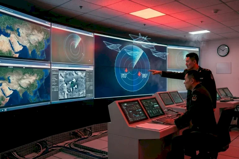
The system used by the company is not a traditional radar or signal interception system, but rather a combination of commercial satellite images, open flight tracking data, and publicly available military records, with artificial intelligence technologies used to analyze this data. This approach specifically, rather than the claim itself, opens the door for a deeper discussion about the idea of "counter-stealth", as another Chinese company used the same tools and what it revealed was far larger than merely tracking the return flight of American stealth bombers.
Importantly, none of this happened due to a scientific breakthrough in radar technology, but rather because of commercial satellites, artificial intelligence techniques, and open-source data available online, along with a global market built by America itself and sold to the world. The question now is: How is the stealth system of the world's most expensive aircraft eroding due to these simple and accessible technologies?
The Modern Shift
Weeks before the "Epic Fury" operation, another Chinese company called "Mizar Vision" was publishing satellite images identifying the numbers and types of American fighter jets and their air defense locations across the Middle East. The company documented and released information about 2500 American military assets deployed worldwide before the first bomb fell on Iranian soil.
In the final month before the operation, the company jumped from posting scattered analyses to daily updates on social media, with unprecedented details about the aircraft and American armament systems and their precise locations in the Middle East and surrounding areas. For instance, just one day prior to the operation, the company published images of seven American F-22 fighters at the Israeli Ovda base along with C-17 aircraft unloading supplies, in addition to equipment at Diego Garcia Airbase in the Indian Ocean.
The company then tracked the aircraft carrier USS Gerald Ford after it left Souda Bay Naval Base in Crete, and published images of the USS Abraham Lincoln as it headed to rendezvous with a supply ship in the Arabian Sea off the coast of Oman. The company demonstrated how to locate aircraft carriers at sea by merging open flight tracking tools with satellite images. Then came Jingan Technology's claim the day after the B-2 Spirit strategic bomber mission.
Mizar Vision was not the only company to see all this; Western newspapers published reports showcasing the full American military buildup based on satellite images, commercial sources, and the same tools.
Interestingly, He Bo, a research professor and director of the Center for Maritime Strategy Studies at Peking University, confirmed that Mizar Vision's images were not captured by Chinese satellites but were sourced from commercial American and European satellites, as evident from the satellites' orbits and image accuracy. In other words, the images that mapped the American battlefield were captured by satellites made by America and Europe and sold in the open market.
Here it becomes clear what has actually been revealed and what hasn't; the B-2 bomber is still invisible to radars, that remains true at least up to this moment. But it has never flown alone; in every operation, it is usually accompanied by the same system: refueling aircraft, munitions transport planes, early warning aircraft, aircraft carriers, and destroyers. This system is an essential part of how any modern air force operates, and what has changed is not the system itself, but the fact that tracking it with such precision previously required military spy satellites and state-level intelligence agencies, while today it requires a subscription to a commercial service.
Notice how some former Chinese officials talk about this campaign; a retired Chinese colonel remarked about Mizar Vision's activity, calling it "a beneficial exploration contributing to China's development as an intelligence power." For Beijing, whether it concerns satellite imagery or claims of intercepting B-2 stealth bomber signals, it may not need to be accurate to achieve its goal, it is sufficient that it reinforces the image of the strength of the Chinese intelligence system and the companies working with it on information collection, along with the modern technologies being employed.
This aligns with the Chinese military doctrine; in April 2024, Chinese President Xi Jinping established the "Information Support Force" as a new strategic branch reporting directly to the Central Military Commission. The primary mission of the force is to develop and operate a multi-purpose network information system that supports joint military operations in any conflict environment and under any enemy attacks. According to analysts from the People's Liberation Army, "success in modern warfare depends on the seamless flow of information," making this network a foundational pillar in both wars and strategic competitions.
Restricting Visibility
On the opposite side, Washington responded by restricting what the world can see; on March 6th, American company Planet Labs imposed a 96-hour delay on its satellite imagery, a company founded in 2010 whose imagery is widely used by media and researchers. Days later, Planet Labs doubled the restrictions to 14 days, expanding the scope to all areas of the Middle East and some geographically contiguous areas where American forces and assets could move.
Similarly, company Vantour imposed similar restrictions and stated that it was determining them "independently." Restricting commercial imagery during conflicts and wars is not a new phenomenon; Planet Labs imposed a 30-day delay during the war on Gaza. However, the context here is different, as these restrictions came after Iran later targeted a number of facilities and properties identified by Mizar Vision with missiles and drones.
But perhaps these restrictions were not just aimed at protecting personnel and equipment; they also followed the use of Planet Labs' satellite images by investigative journalism teams to analyze the strike on the Minab Primary School for girls and to verify the type of missile used. Journalists pointed out that this delay, which later turned into a ban, "slows verification and makes establishing facts more difficult," and they confirmed that Planet Labs' satellite imagery allowed their teams to analyze the strikes on the school.
U.S. Defense Secretary Pete Hegseth stated that "open sources are not the right place to determine what happened or what didn't happen." However, when open sources are indeed the only tool available to the world to understand what is happening in a war where accurate information is lacking, restricting them aims not just at protecting military assets but at protecting the narrative as well.
Here, the reactions intersect; China may be amplifying what it can see, while America restricts what others can see, but both sides implicitly acknowledge that commercial data has become capable of revealing what was assumed to be classified. Beijing is now investing in this modern shift, while Washington is trying to slow it down, but neither can reverse its direction. To understand the nature of this shift, we must go back to the 1980s.
Changing the Equation
When Northrop engineers designed the B-2 stealth bomber, their specific enemy was the Soviet radar networks. Every line in the aircraft's structure, every angle, and every layer of paint was designed to minimize radar signature. The principle was simple; if the radar does not see you, you cannot be intercepted.
This principle was valid because radar was indeed the only way to see what was happening in the sky. But it also applied for another often-unmentioned reason; the environment surrounding the aircraft was protected by a natural information dark. Detecting bases, support aircraft, and supply chains back then required military satellites and state-level intelligence.
Today, as we have seen, that darkness and protection have been revealed, and there are now three trends that did not exist when the first lines of the B-2 bomber were drawn on paper. The first trend is the number of eyes in space; when the B-2 entered service in 1997, the satellites capable of capturing high-resolution images were the monopoly of a handful of countries. Today, the Jilin-1 constellation (the largest commercial Chinese remote sensing and Earth observation satellite network) alone comprises around 300 small satellites and can produce images with half a meter resolution, including live video of moving targets.
On the other hand, Planet Labs has a fleet of satellites imaging every point on Earth multiple times a day, and Vantour provides images with 0.3-meter resolution. These are not government spy satellites but commercial products available to any paying client. The Pentagon estimated in 2022 that China "owns and operates about half of the intelligence, surveillance, and reconnaissance satellite systems in the world," which only includes military capabilities. When commercial satellites are added, space becomes crowded with eyes that are not beholden to a single authority.
The second trend is artificial intelligence technologies. What required dozens of analysts to scrutinize satellite images and determine aircraft types is now performed by software scanning thousands of images and automatically detecting patterns of deployment. This is precisely what Mizar Vision did, as they purchased commercial images and converted them through artificial intelligence into ready intelligence. The process no longer requires permission from a specialized intelligence agency but can be done by a well-funded startup.
The third trend lies in the availability of open-source data. Flight tracking websites are accessible to everyone. For example, the Jingqi system from Jingan Technology works by merging satellite images with flight path data and publicly available military records, then analyzing the patterns. Analysts call this "stealth transparency"; the stealth aircraft are designed to evade radar, but they operate within a network operationally supported by refueling aircraft, logistical movements, and fixed bases, and this network, which was previously protected by information darkness, is no longer shielded.
Here it should be clarified that part of this picture was available before; there are sites that can track military aircraft broadcasting their signals while flying through civilian airspace. Anyone monitoring the movement of transport and refueling aircraft in the weeks leading up to the operation would have noticed an unusual flow towards bases in the Middle East.
But tracking flights alone does not reveal the amount and quality of equipment that actually arrived in the region; F-35 and F-22 fighters typically fly with their transponders turned off in operational areas, so they do not show up on any tracking screen. Flight tracking sites do not account for what is parked on runways or specify the locations of air defense systems, nor do they image the surface of an aircraft carrier.
What commercial satellites added is the layer that reveals everything that flight tracking fails to see, that is, fixed assets on the ground. And what artificial intelligence brought is the ability to merge the two layers together, aerial movement and ground imagery, into an integrated and near-instant operational map. The difference is not between vision and blindness but can be considered between scattered shards that an expert can assemble and a complete warfare map now published on social media.
Simply put, the B-2 bomber was designed for a world where radar was the only eye, and the environment around it was dark, but it is flying today in a completely different world. However, "commercial transparency" is not the only front in revealing stealth; China is not content with merely attempting to detect stealth from the outside but is also actively working to attack it from internal fronts.
New Radars?
Stealth technology was built on a specific physical principle: paint and geometric design deflect or absorb high-frequency radar waves. But this works with certain frequencies and not all, and here lies Beijing's attempts to transcend stealth in multiple areas.
The first area today is meter-wave radars. In May 2025, the Chinese government electronics technology group showcased the radar "JY-27V" at the global radar exhibition, describing it as a "clever artist" in detecting stealth targets. The idea is simply that it does not use short wavelengths that aircraft are designed to absorb, but much longer waves, ranging from 30-300 megahertz. These long waves are difficult to absorb; doing so would require thicker and heavier coatings, which creates a problem for the aircraft itself, affecting its agility and performance in the air. The radar is also practical and can be rapidly deployed, as it can be mounted on a truck and set up in less than ten minutes.
However, meter-wave radars are not a decisive weapon by themselves; they can detect the presence of a ghostly target, but their accuracy in pinpointing location is lower than high-frequency radars, complicating the task of guiding an interceptor missile solely based on their data. Their true value, and their actual ability to threaten the enemy, lies in serving as the first link in a multi-layered sensing network, where the meter radar reveals the target and alerts other more precise systems to take over tracking and guidance.
The second, more ambitious area is quantum radars. In October 2025, Chinese media reported the start of large-scale production of quantum radars believed to have the capability to detect stealth fighters like the F-22 and F-35. While conventional radar sends radio waves that bounce off objects, quantum radar uses light particles known as photons instead of radio waves, allowing for a higher sensitivity level in detecting targets.
In this type of radar, it is possible to deal with a single photon and measure its properties accurately, such as energy and direction. When the photon enters the device, its energy is converted into a small electrical signal that can be analyzed. The system also relies on the phenomenon of "quantum entanglement," where two connected photons are produced. When one is sent towards the target, any change occurring in it can be detected through the other photon located within the device, aiding in the discovery of objects even if the reflected signal is weak.
However, there are currently no published scientific data or documented field experiments proving these radars' ability to detect stealth aircraft under real operational conditions. Industry experts note real technical challenges, the most significant of which is the difficulty of maintaining quantum entanglement in practical environments, as well as the effects of noise and interference, which may limit these systems' efficiency in military use. Nevertheless, the general trend does not require every individual claim to succeed; this multi-front pressure, from radars to quantum mechanics to commercial transparency, continues to shrink the space in which the concept of stealth operates year after year.
Bridging the Gap Between America and the World
The concept of stealth, in its broadest sense, is not merely a coating on an aircraft, but can be regarded as a foundation for a complete model for showcasing and projecting power, by moving state armies across oceans, deploying them in distant bases, and striking targets anywhere without anyone perceiving you before executing your strike. This has enabled Washington to wage its past wars with a significant asymmetry of information; it sees the battlefield, while its opponents see only what it decides to show them. What has transpired in the war against Iran may indicate that this asymmetry is beginning to recede.
Diana Stroul, the former Deputy Assistant Secretary of Defense for Middle Eastern Affairs, pointed out that Iran has successfully exploited "a wide-ranging intelligence network... and that there is much satellite imagery available now for purchase, along with what they were getting from the Russians and Chinese."
Meanwhile, Seth Cromartie, former Chief of Staff for U.S. Special Operations Command in the Middle East, went further, stating, "No one has achieved more than the Iranians with fewer resources. Iran possesses accurate intelligence, not just about the locations of our bases, but about many of our lifestyles and military operations." This isn’t an evaluation from an external analyst or merely a Chinese claim, but a recognition from an expert with extensive knowledge of the American military establishment.
In addition to the erosion of information darkness, there are transformations linked to it, though differing in nature. Alain Juillet, former director of intelligence at France's External Security Service, reported that Iran has likely acquired the Chinese BeiDou navigation system, which explains the improvement in the accuracy of its missiles compared to last June's war. The BeiDou system operates with 45 satellites compared to 24 in the American GPS system, and importantly, Washington cannot disable it. If Iran indeed uses this system, the issue no longer pertains solely to the concept of stealth, that is, America's ability to remain unseen, but involves monopolizing the guidance system that enables others to strike accurately.
The B-2 bomber was designed for a world where a limited number of countries had the capacity to see, and Washington was the one controlling what could be seen and what could not. Of course, that world will not disappear overnight, nor will American military superiority evaporate just because a Chinese company posted images of American military gear on social media. However, the direction we are heading towards is now clearer than ever, and the tools are accessible to those who want them, from commercial satellites to artificial intelligence and open-source data, with the costs of using all of this decreasing year after year.
Source: Al Jazeera
 Follow the latest Sada News via Google News
Mohammed bin Salman and Trump Discuss Cooperation Relations and Regional Developments Over...

Death Toll from Venezuela Earthquakes Exceeds Four Thousand

North Korea: Senior Military Official Removed from Ruling Party Over Corruption Allegation...

Six Injured in Russian Attack on Ukrainian Capital Kyiv

US Treasury Department Issues New Sanctions Related to Iran

Eight People Charged with Planning Attack on the White House to Assassinate Trump, Vance,...

American Official: We Will Oversee Israel's Withdrawal from "Experimental Areas" in Lebano...
